Decades-Old Images Excite Scientists By Revealing Active Volcanic Activity On Venus

Surprisingly, the newly found evidence was found in archival radar images from the 1990s, during NASA's Magellan mission. While pouring over the earlier images, scientists were able to unveil a volcanic vent changing shape and substantially increasing in size in under a year's time.
"NASA's selection of the VERITAS mission inspired me to look for recent volcanic activity in Magellan data," explained Robert Herrick, a research professor at the University of Alaska Fairbanks and member of the VERITAS team. "I didn't really expect to be successful, but after about 200 hours of manually comparing the images of different Magellan orbits, I saw two images of the same region taken eight months apart exhibiting telltale geological changes caused by the eruption."
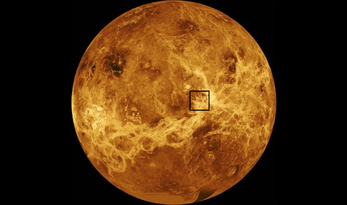
Annotated, computer-simulated global map of Venus’ surface. Courtesy of NASA/JPL
By studying active volcanoes, scientists can better understand how a planet's interior can "shape its crust, drive its evolution, and affect its habitability," according to a recent NASA blog. VERITAS will aid in the study of volcanic activity on Venus by studying the planet from surface to core.
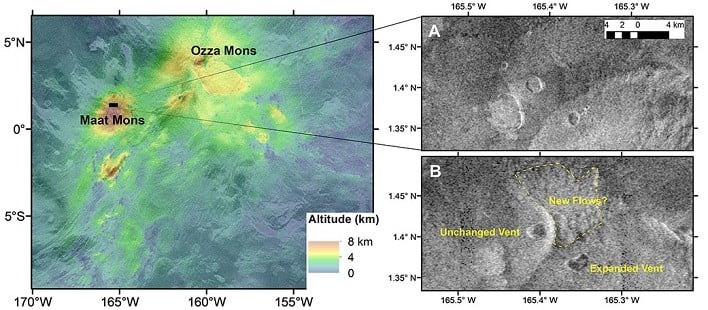
Due to the observations being taken from opposite viewing angles, it was difficult to compare them. The low resolution of the images also hindered the process of investigating them. Herrick partnered up with JPL's Scott Hensley and together created computer models of the vent in various configurations to test various scenarios. It was from those models that the duo was able to conclude only an eruption could have caused the change in landscape.
"Only a couple of simulations matched the imagery, and the most likely scenario is that volcanic activity occurred on Venus' surface during Magellan's mission," remarked Hensley. "While this is just one data point for an entire planet, it confirms there is modern geological activity."
