Google Maps Gives London a 3D Makeover
It may not beat being there in person, but viewing 3D cities in Google Maps is a worthwhile experience. Google Maps and Google Earth update with 3D cities on a regular basis and the list is now in the hundreds, but what caught people’s attention today is that London has finally made the list. Thanks to aerial mapping, you can “fly” over the city with same perspective as you’d have in a plane.

The London Eye in Google Maps 3D.
Using the 3D feature is a piece of cake. Visit Google Maps, type London into the search bar, and click the Earth button to switch from the traditional map view. At that point, you can use the Rotate and Tilt buttons at your right to change your perspective and from that point it’s just a matter of zooming in.

Big Ben in Google Maps 3D.
Sure, some of the rooftops seem a little blurry at certain angles, but by and large, Google’s 3D map provides clear images that make for a realistic experience. Google has mapped cities all over the world, including many U.S. cities. If you haven't already taken a spin through Chicago or Los Angeles, give it a whirl.
The London Eye in Google Maps 3D.
Using the 3D feature is a piece of cake. Visit Google Maps, type London into the search bar, and click the Earth button to switch from the traditional map view. At that point, you can use the Rotate and Tilt buttons at your right to change your perspective and from that point it’s just a matter of zooming in.
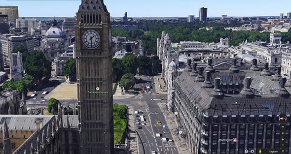
Big Ben in Google Maps 3D.
Sure, some of the rooftops seem a little blurry at certain angles, but by and large, Google’s 3D map provides clear images that make for a realistic experience. Google has mapped cities all over the world, including many U.S. cities. If you haven't already taken a spin through Chicago or Los Angeles, give it a whirl.