Google Maps Now Updating Live Bus Results In Select Cities
Need to know exactly where your bus is? Who doesn't, right? Google, in typical fashion, has just made one of life's chores even easier. Starting now, Google Maps for mobile and desktop is capable is telling you when your bus is actually going to arrive, courtesy of live transit updates. The company has partnered with transit agencies to integrate live transit data in four U.S. cities and two European cities: Boston, Portland, Ore., San Diego, San Francisco, Madrid and Turin.
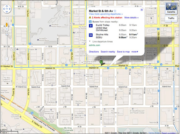
They're already making strides in telling folks when mass transit options are going to be late or on time, and the bus is the next logical piece of the puzzle. When you click on a transit station or plan a transit route with Google Maps and there are delays or alerts related to your trip, you’ll now see “live departure times” (indicated with a special icon) and service alerts.
Hopefully it'll roll out to many more cities in due time, but if you happen to live in one of the locales here, let us know how the system works out for you.